
■ Sound familiar
Why community development gets buried in paper
Most departments are not short on diligence. They are short on one system that holds the permits, the licenses, and the cases.
NovoGov Community Development Software
NovoGov Community Development Software is a cloud-based system that municipalities use to manage building permits, code enforcement cases, business licenses, and animal control from a single connected platform, with custom letters, reports, and approvals generated in seconds. Some governments call this municipal permitting software or community development licensing software; the job is the same either way.
Inspectors manage and update inspections and violations from a phone or tablet in the field, and records are geotagged against your GIS parcel data. It connects to the work order and asset management tools your public works and utility departments already use.
■ Permitting
From application to certificate of occupancy
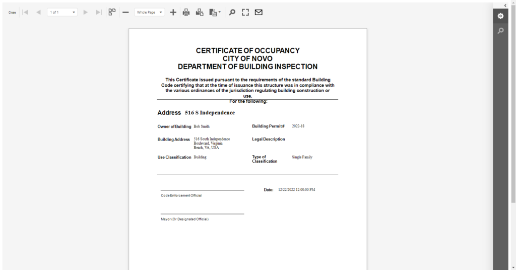
Track building permits, right-of-way permits, and more with multi-department workflow routing, so each application moves to its next reviewer instead of waiting in a tray. Permit types cover new construction, remodels, land-use, and zoning. Inspectors add or update permit inspections from the field in real time, and building permits and certificates of occupancy are generated with a click.
■ Code enforcement and cases
Every case with its photos, letters, and history
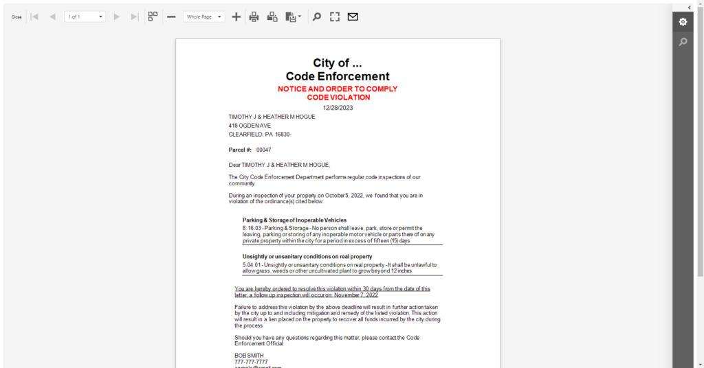
Code violations and animal control cases live in the same system. Perform inspections, attach photos with the GPS location captured, and let residents submit complaints online. Letters print with GIS parcel data merged in, so the property owner’s details fill themselves in, and cases can be geocoded, tracked, and reported on from the office or the field.
■ Licensing and reporting
Licenses, renewals, and reports that run themselves
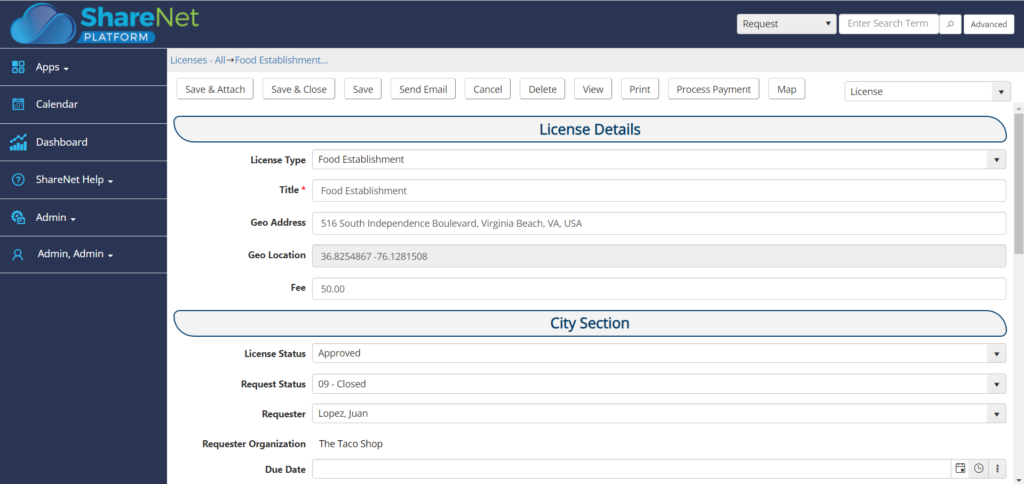
Track business, contractor, restaurant, hair salon, and liquor store licenses by type, color coded on the GIS map. The expired business license list keeps payments and renewals visible, and licenses, renewal and warning letters, and payment receipts print straight from the system. Health and safety inspections happen on site from a smart device, and custom reports can be created to report on anything.
■ What switching looks like
Going live without closing the counter
The counter stays open the whole time. Nothing gets turned off until the new system is running.
What our clients say
Steven Pilcher, Director of Public Service

“The NovoGov Municipal Software has really helped streamline processes, reduce costs, provide better metrics, and run a more efficient public service department, which in turns creates a better relationship between department staff and the customers served.”

Andy Elder, Street Foreman

“Our Streets team really likes NovoGov, especially because of its mapping capabilities and that I can see all the work orders on my phone while I’m out in the field. Now if a request comes in, I can take snapshots of the work to be done, work in progress, and finalized work, which all help to show proof of the process. The ability to easily document work, locate assets, and manage preventative maintenance of assets on one system is everything to our department. The NovoGov application has saved us a lot of time. Now we have access to documentation in real time vs. lost on a massive worksheet on the office computer.”

Travis Sirrine, Highway Superintendent
“The Board of Selectmen was blown away the first time I showed them what we could now report on. They had no idea how many tasks we handled. Now they have data—charts, work orders, asset histories. It changed the conversation.”
Travis Sirrine, Highway Superintendent

David Seugling, Public Works Director
“Switching to NovoGov has been a game changer for our department. It’s streamlined communication, eliminated paperwork, and made it easy for our field crews to update work orders in real time. The system is incredibly flexible and user-friendly — I’d make the switch to NovoGov again in a heartbeat.”
David Seugling – Public Works Director

Todd Philbrook, Public Works Director
“NovoGov works REALLY well for us. It’s easy to enter data, easy to look up complaints, and flexible enough that it can be tailored to match exactly how we operate. The support has been phenomenal, and it’s saving us time across the board.”
Todd Philbrook, Public Works Director

■ Taking it to the board
What this looks like in a council packet
■ Built for government
What your procurement team will ask
■ Questions we get
Community Development Software FAQ
■ Next step
Request a demo
A working session on your own permits and cases, not a slide deck. We will show you how a permit moves through review, how a violation letter prints with parcel data filled in, and what the report looks like at the end of the quarter.